
Develop your own cartographic representations or perform your own GIS analyses with SolarGIS data.
Purchase data from SolarGIS database for your own GIS jobs. GIS data resolution and format are prepared to meet your needs. The most typical examples are available below. Download a set of SolarGIS sample data and try in your favourite GIS software.
Contact us to purchase data for your region
.
GRIDed Data (Raster)
GRIDed Data (Raster)
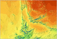
- The nature of solar radiation and othe climatic parameters have rather continous character, therefore GRIDed (or Raster) data are the most suitable format to express such behaviour
- We are capable to deliver data in high resolution (Solar and PV parameters up to 9 arcsec = approx 250 m). Consult our maps in SolarGIS iMaps
- Typical format: ESRI ASCII GRID, spatial reference EPSG:4326 (also known as GCS_WGS84); Another format on request
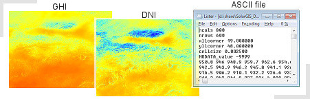
Provided ZIP files contain ASCII GRID file and PRJ project file:
- Grids 800x600 pixels, resolution 00:00:09 = 9 arcsec (approx. 250 m)
- Geographic coordinate system, World Geodetic System 1984 (GCS_WGS84)
- region of Central Slovakia, Europe (North:49.5°, South: 48°, West: 19°, East: 21°)
Snapshot of the samples
Point Data (Vector)
- Point data represent selected characteristic for a particular site
- In special cases, regular point data can replace GRIDed data (e.g. Clickable maps for Google Earth)
- Typical format: ESRI Shapefile or KML/KMZ, spatial reference EPSG:4326 (also known as GCS_WGS84); Another format on request
Download Sample Data
Provided ZIP files contain point shapefile with attribute table and predefined examples of color legends for QGIS and ESRI ArcMap software:
Snapshots of the samples
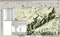
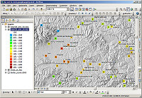
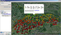
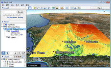
Image Data/Maps
GHI: Western Cape, South Africa (ZIP file, 3.6 MB)
- High quality cartographic representation of selected climate parameter, supported by terrain shading
- Can be used as Google Earth overlay map or as an image in your GIS to compose your own map with additional layers
- Typical format: georeferenced image file (PNG with transparency or GeoTIFF), spatial reference EPSG:4326 (also known as GCS_WGS84); Another format on request
- Download Sample DataBeside GeoTIFF file the samples also provide KML file to open data in Google Earth application
GHI: Slovakia, Europe (ZIP file, 2.5 MB)
Δεν υπάρχουν σχόλια:
Δημοσίευση σχολίου